A Māori artist unveils his free-standing two-storey pou on State Highway 2 to recognise the history of Te Aitanga a Māhaki as travellers enter into the heart of Tairāwhiti.
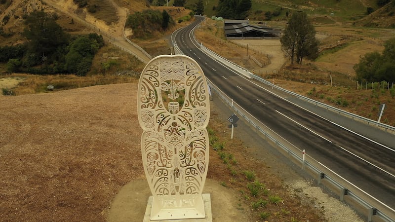
Nick Tupara, a well-respected Māori ringa toi of Tūranga Nui a Kiwa created the 7-metre tall monument to the history between Te Aitanga a Māhaki boundaries and Te Whakatōhea in the Bay of Plenty.
It is part of an ambitious project by the New Zealand Transport Agency to replace the original one-lane Motu Bridge. The project to construct a two-lane bridge took three years, costing $7.6 million to complete.

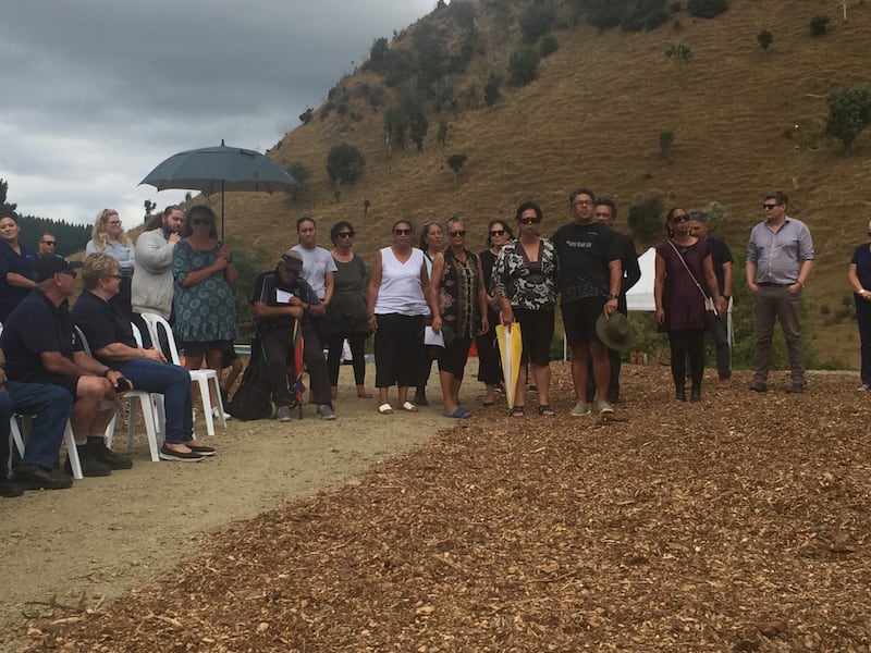
Members of Te Aitanga a Mahaki. Photo / FIle
Today, uri from Te Aitanga a Māhaki attended the unveiling of the historic monument and the bridge which was given a new name Te Whitinga o Tamataipunoa that stands proud in the Matawai Valley 70 km out of Tūranga.
“We want people to hear the karanga of our people,” Tupara says.

Te Whitinga o Tamataipunoa. Photo / File
Three tīpuna figures of te ao kohatu make up the pou which is coated in white paint that symbolizes the mist or kohu that shrouds the steep hill country in the lands of Māhaki.
Sitting at the top of the pou is the ancestress of Ngāti Ruapani, Hinetapuarau, who was the wife of Māhaki. Tupara wanted to use her firstly as a visual presence because the mana in most cases came from tīpuna wahine, he says.
Below her is the face of Tamataipunoa, a younger brother of Tutamure, both were some of the first settlers in Ōpōtiki who travelled by foot to the East Coast.
The journey resulted in Tamataipunoa marrying Tauheikuri of Te Mahia in the Hawke's Bay.
That was the origin of their son Māhaki, and his people's story in Tairāwhiti.
Local schools attended the unveiling of the monument, to which Te Aitanga a Mahaki rangatira Wirangi Charlie Pera said that the event was significant as New Zealand schools will be teaching Māori history by 2022.
“Seeing kids going back to school after this event and talk about our tīpuna Tamataipunoa and his journey, as well as Hinetapuarau.”

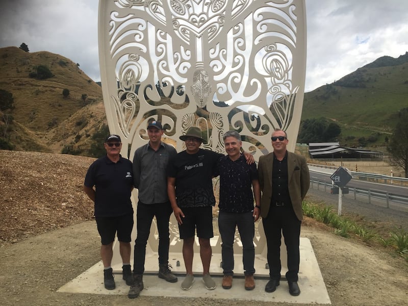
Project team. Photo / File
For artist Tupara, the process was a long task which took up to a year to create Te Whitinga o Tamataipunoa. The monument made from metal was cut and rolled into five different pieces and shipped to Gisborne from Wellington.
Creating pou for new bridge
The original arawhiti Motu Bridge was a narrow, one-lane bridge. It was considered by NZTA to have poor alignment when vehicles approached it. It is situated 70 km north-west of Tūranga, west of the small settlement of Matawai.
The project was to build a two-lane structure and improving the road alignment making journeys more efficient for freight. When landslips occurred the bridge was unstable, causing drivers up to five hours of extra travel time from the Bay of Plenty.
Background
Constructed in 1930, the Motu Bridge supports the local farming community and the movement of goods between Ōpōtiki and Gisborne. The 142 km section of SH2 where the bridge is located includes 52 bridges.
It is the only one-lane bridge on the road between Gisborne and Opotiki and requires ongoing maintenance to keep it operating to capacity.
Recent investigations identified ongoing resilience issues on the route, highlighted by the 2012 slip at Waioeka Gorge (South of Ōpōtiki). In the event that the bridge is closed, the alternative route between Gisborne and Ōpōtiki, via the East Cape along SH35, adds an extra 185 km (2.5 hours) to the journey.
Given that a high proportion of the vehicles using the bridge are heavy vehicles, such as tractors and freight trucks, the need for a strong and reliable bridge is paramount in this small community.
In addition, minor travel time delays occur when vehicles have to wait to cross the single lane. There have also been crashes on or near the bridge resulting in minor injuries.

